Carderock Recreation Area Pavilion
4 mi west · National Park Service
The picnic pavilion at the Carderock Recreation Area is a large covered pavilion, open on three sides, that accommodates a maximum of 200 people.
Outdoors
National forests, parks, lakes and recreation areas with hiking trails near Bethesda, closest first.
Good to know: Carry more water than you think you need, check the managing agency’s page for trail closures and fire restrictions, and start early on hot days.
4 mi west · National Park Service
The picnic pavilion at the Carderock Recreation Area is a large covered pavilion, open on three sides, that accommodates a maximum of 200 people.
4 mi southeast · National Park Service
Rock Creek Park is truly a gem in our nation's capital. This 1,754 acre city park was officially authorized in 1890, making it the third national park to be designated by the federal government.
4 mi southeast · National Park Service
Eight group picnic areas in Rock Creek Park are available for advance reservation from April 1 through November 30. These picnic areas are available on a first-come, first-served basis from December 1 through March 31.
Map of 26 places loads as you scroll.
The picnic pavilion at the Carderock Recreation Area is a large covered pavilion, open on three sides, that accommodates a maximum of 200 people.
Rock Creek Park is truly a gem in our nation's capital. This 1,754 acre city park was officially authorized in 1890, making it the third national park to be designated by the federal government.
Eight group picnic areas in Rock Creek Park are available for advance reservation from April 1 through November 30. These picnic areas are available on a first-come, first-served basis from December 1 through March 31.
On forested hills surrounding the nation's capital are the remnants of a complex system of Civil War fortifications. These strategic buttresses transformed the young capital into one of the world's most fortified cities.
Scouts built the Marsden Tract Group Campground to provide access to larger campsites within easy commuting distance of the D.C. Metro area.
Preserving America's early transportation history, the C&O Canal began as a dream of passage to Western wealth.
At Great Falls, the Potomac River builds up speed and force as it falls over a series of steep, jagged rocks and flows through the narrow Mather Gorge. The Patowmack Canal offers a glimpse into the early history of this country.
In the 1930s, landscape architects transformed Mason’s Island from neglected, overgrown farmland into Theodore Roosevelt Island, a memorial to America’s 26th president.
From this distance the seat of national power appears pristine across the river, so President Johnson came here often when he needed to escape from the stresses of building a Great Society.
No matter what your age or taste in shows, you'll find something you like onstage at Wolf Trap National Park for the Performing Arts.
Deep within Kenilworth lies an oasis, hidden behind trees and cattails. It's a place where beavers build their homes and turtles sleep on logs. Lotus blooms rise from the muck and lilies sit on the water.
Fort Dupont Park has three picnic areas that groups may reserve from spring to fall each year. There are also picnic areas available on first-come, first-served (no reservation required).
Greenbelt Campground is an urban oasis just 10 miles (16 km) from Washington, D.C. This beautiful, wooded park is known for its safety, affordability, peaceful surroundings and National Park Service hospitality.
Enjoy affordable camping, hiking, and peaceful forest surroundings just ten miles from Washington, DC!
You may book a picnic areas up to six months ahead. Greenbelt Park is an urban oasis just 10 miles (16 km) from Washington, D.C. This beautiful, wooded park is known for its peaceful surroundings and National Park Service hospitality.
The diverse history of Maryland and our national heritage can be experienced at Oxon Cove Park. Through hands-on programs and other activities, you can experience farm life and how its changed over time.
Patuxent Research Refuge was established in 1936 by executive order of President Franklin D. Roosevelt, and is the only wildlife refuge established to support wildlife research. Today the U.S.
Fort Hunt Park provides six picnic rental areas: Area A, Area B, Areas C1, C2, C3, and Area D. Picnic pavilions are in Area A, B, C-2 and D. Areas C-1 and C-3 are open areas with picnic tables only.
Fort Washington is located 15 miles (24 km) south of Washington, D.C., along the Potomac River. It is a local favorite for picnicking, recreation and historic interest.
Oak Ridge Campground is a 100-site, wooded campground located in Prince William Forest Park, 35 miles (56 km) southwest of Washington, DC.
Prince William Forest Park is located 35 miles southwest of Washington, D.C., the park's land was set aside during the Great Depression.
Cabin Camp 3 is located in Prince William Forest Park and is one of five large cabin camp facilities located in the park. Camp 3 is the only camp where visitors can rent a single cabin. There are thirteen cabins available for rent.
Telegraph Picnic Pavilion is a covered pavilion with twelve picnic tables located in Prince William Forest Park, 35 miles (56 km) southwest of Washington, D.C.
Looking for some peace and quiet? Want to get back to nature, listen to the sounds of the nocturnal world, or simplify your life? Then come experience primitive camping at Prince William Forest Park’s Chopawamsic Backcountry Area.
The Antietam Creek Campground is located at Mile 69.4 on the C&O Canal Towpath, a few miles south of Shepherdstown on the Maryland side of the Potomac River.
THIS IS NOT A PUBLIC CAMPGROUND. ONLY SCOUTS AND CIVIC ORGANIZATIONS MAY USE ROHRBACH CAMPGROUND. Antietam National Battlefield is the site of the bloodiest one day battle in American history.
Distances are straight-line miles from the center of Bethesda. Listings come from Recreation.gov’s federal recreation database; check each official page for hours, fees, fire restrictions and closures before you go.
THINGS TO DO · YOUTUBE SHORT
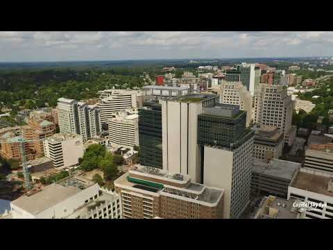
An aerial tour of downtown Bethesda around the Wisconsin Avenue, Old Georgetown Road and East-West Highway intersection.
Watch on YouTube ↗
THINGS TO DO · YOUTUBE SHORT
A quiet ride through Bethesda’s central business district.
Watch on YouTube ↗Carderock Recreation Area Pavilion (National Park Service), about 4 miles west of Bethesda as the crow flies. Next are Rock Creek Park (4 mi) and Rock Creek Park Group Picnic Areas (DC) (4 mi).
Based on Bethesda’s average highs, February–May, September–December. Conditions at higher elevations can be much cooler.
Federal agencies including National Park Service, Fish and Wildlife Service. Each listing links to its official page for hours, fees, closures and current conditions.